Protester NGO in the Bella Center wearing shirt with a global map on it. "Don't Bracket our Future" is referring to the practice of bracketing lines of text in the document negations for further review. Often a method to delay agreement rather then actually make a negotiation effort.
 Large global art in the middle of the Bella Center.
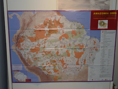
 Map of indigenous populations in the Amazon of South America.
NeoGeography applications using GIS to communicate green energy resources of Denmark.

Maps used in documentations used to promote credit systems rather then taxes to solve CO2 pollution.
 Map showing potential BioGas reserves in the US.
Wall depicts the global models of global warming temperature increases.

Copenhagen logo is an abstract depiction of the globe.

In the Hopenhagen Plaza a large globe was setup in the middle of the festival. The globe features a projection system which animates the globe.

Global art spread throughout the city in the metro stations.
No comments:
Post a Comment
Note: Only a member of this blog may post a comment.